Looking for Kossuth in early antebellum Atlanta
Ron Feigenblatt
February 2013

|

Lajos Kossuth (lithograph of 1853) |

|
The celebrated Hungarian patriot
Lajos Kossuth
visited the Georgia towns of LaGrange, Atlanta and Augusta during
April 7-9, 1852, as part of a
Cook's tour
of the United States. A story which includes Kossuth's brief time in young Atlanta is
recorded
in
History of Atlanta, Georgia: with illustrations and biographical
sketches of some of its prominent men and pioneers, Wallace Putnam Reed,
editor (D. Mason & co., 1889). It reads in part so:
Colonel D. N. Sloan, one of Atlanta's old and enterprising citizens, came to the place in the year 1850... he [had] left his home in South Carolina with the determination to see at least a part of the country. His money was stolen from him on his way to Macon, Ga., and when he reached Macon he was destitute of funds. Consequently he had to go to work. Through a friend in Macon he obtained letters of recommendation to Mr. Emerson Foote, superintendent of the Macon and Western Railroad, and president at that time of the Macon and Western Telegraph Line. Thus Mr. Sloan obtained a position as telegraph operator at the station in Atlanta, and was the first telegraph operator Atlanta ever had. |
Atlanta circa 1852
Events of 1852
|
From where did Kossuth send his telegram?
The book Atlanta and Environs: without special titles (U. Georgia, 1969) writes:
The arrival of Samuel F. B. Morse's invention in Atlanta was heralded by the Macon "Journal and Messenger" of February 7, 1849:"The Telegraph to Atlanta... The work of erecting the posts has already been commenced, and it is supposed that the line will be in operation in two or three months."The prediction was fairly accurate. The line was completed to Atlanta in May and an office established in the Macon and Western Depot in the State Square. Colonel C. R. Hanleiter, esrtwhile publisher of the "Southern Miscellany," was installed as operator...
1853 |  Above: Section of the 1853 map
prepared by Edward A. Vincent, episodically overlayed by a contemporary (2013)
aerial photograph marked with current street names. The 1853 map's legend,
which marks three dozen major structures, appears below.
Above: Section of the 1853 map
prepared by Edward A. Vincent, episodically overlayed by a contemporary (2013)
aerial photograph marked with current street names. The 1853 map's legend,
which marks three dozen major structures, appears below.
| |
 |
Which railroad building was which?
Even in 1853, Atlanta was already served by three different railroads, (viz. W.A.R., G.R.R. and M.W.[R.]), each having facilities marked on the Vincent map, which documents a single structure in State Square, "General Passenger Depot," labeled "G." Should one assume this is the "Macon and Western Depot" which the book above asserts was the 1849 location of the telegraph office? That book also reports:
The original wooden passenger shed on State Square, which had sufficed through the early pioneer days had, by 1852,[the year of the Kossuth visit] become sorely inadequate... The budget of the Western and Atlantic for 1853 included an appropriation for a "Passenger House" in Atlanta... Building... was completed late that year or early in 1854. Overall dimensions of this architectually pleasing brick depot were 100 x 300 feet... The station was served by four tracks, one for each of the roads entering the city... It served the city and the railroads well until its destruction by the Federal army in November, 1864.This shows that while one railroad might pay for a depot, it would serve the others as well, making it not implausible that the previous wooden "General Passenger Depot" had been owned by the Macon and Western, and served as the location of the telegraph office, as Atlanta and Environs... (1969) claims.
But the Vincent map also marks two buildings ("E" & "F") as specifically belonging to the Macon and Western, the latter being the "M. W. D---nt Warehouse," barely off State Square. Could the telegraph office actually have been in building "F"? As we will observe below, the telegraph wires we see in photographs made during 1864 run outside of Railroad Gulch, strung along the SSW side of Alabama Street, with none observed on the NNE side of the gulch. Like Alabama Street, building "F" enjoys the virtue of lying beyond the SSW edge of the gulch, and so may have been the original destination of the wires.
Further confusion is sewn by a manifestly contradictory report appearing in an early source, the book Pioneer citizens' history of Atlanta, 1833-1902 (Byrd, 1902). It states:
Report of Special Committee, A. Leyden, chairman: The Macon & Western Branch Telegraph Company was organized in 1849, and the line built to Atlanta about May of the same year. Colonel C. R. Hanleiter was the first, operator, and his son, William R., and Augustus Shaw, the first messengers. The office was in the Macon & Western Railway building, southwest corner Pryor and Alabama streets.
The 30-degree East-of-North tilt of Atlanta's downtown street grid makes this description a bit sloppy, but one nonetheless believes Leyden's group meant the parcel marked 1 on block 4 of the Vincent map. Unfortunately, the map shows no building on said parcel; but on parcel 10 of block 3, the "southeast" corner across Pryor Street, Vincent marks as building "a" some unnamed hotel. (Both locations are just outside of State Square.) Below, we will present more evidence about building "a."
Photos of telegraph wires
We have no photographs or even drawings from 1852, but because of the Civil War, Atlanta was extensively photographed only a dozen years later, in 1864, by George N. Barnard, official photographer of the Chief Engineer's Office in Sherman's army, just before the destruction of any remaining strategic infrastructure there useful to Confederate forces. These photographs have been meticulously analyzed by journalist and serious lay historian Ken Denney, who published the results in 2009 at his exemplary Web site Secrets of George Barnard's Photographs of Atlanta in the year 1864. (This marvelous effort includes panoramas constructed by stitching together multiple photos and autostereoscopic animations derived from stereopticon shots!)
Of particular interest to us now are the photos of the View Three page. The synthesized panorama at the page top reveals what appears to be three telegraph wires crossing high over the street (then called Whitehall, today Peachtree) in the right-hand photo. That these are no mere scratches born of old age is immediately evident when Denney identifies a pair of telegraph poles (Inset G of Picture V3-2, lower on the page) running along the SSW side of what is still called Alabama Street. This is because the insulating standoffs on the poles have the correct mean height and proper irregular spacing to match the three aforementioned wires.
| ASIDE: What about another steropticon pair (left and right) of images? They are shot roughly from the Whitehall-Alabama intersection, apparently through a pair of such telegraph wires. Did Barnard prop a stepladder against the gaslight standing on the WSW corner of this intersection to climb high enough to take these photos? Denney himself speculates on such use of a ladder, as shown in the photograph here. |
The US-origin Web page here explains that in this era of (ground-return) telegraphy:
Railroad telegraph and telephone circuits were designated for specific communication functions. L.E. Trump explains the purpose of the different circuits:The "DS" wire was a wire that usually spanned only an operating division or portion thereof under the control of a single dispatcher, and was reserved for exclusive use in transmitting train orders, and "OS"ing train movements.
The RR "message wire" was used primarily for railroad company message business from RR HQ to it's operating personnel and agents along the line. RR message wires terminated in the division or main relay office of the RR.
The Western Union wire was used for commercial telegrams and terminated in the nearest WU large city relay office. WU telegraph service was thus universally available at most RR depots when the RR telegraph office was open and manned. RR ops got a commission from handling the WU business.
This is why you often see three wires depicted in RR depot photos...
Two hotels on Alabama Street
Concerning Inset G, Denney writes:
...a telegraph pole standing near the Gate City Hotel (Inset I), which served as the headquarters of the Confederate Army Signal Corps until the Federal artillery bombardment in August, 1864. Even before that, the hotel was the only place in town that i have found that people could send and receive telegrams.Notably, writing about Sherman's partial demolition of Atlanta in 1864, Barnwell's Atlanta city directory (1867), states on pg. 31:
Several good buildings on Alabama street, east of Pryor, including the Gate City Hotel, were also saved.Together with Denney's analysis of the Barnard photographs, this seems to place the Gate City Hotel at location "a" in the 1853 Vincent map, where an unnamed hotel was indicated, as mentioned above.
| ASIDE: Page 251 of Barnwell's... records that Shermanton, E, telgh opr, bds ["boards"] at Planters' Hotel. This would be convenient, as the Denney analysis places Planters' at the WSW ("southwest") corner of the Alabama-Pryor intersection, just across Pryor from the Gate City Hotel. |
Consistent with Denney's anaylysis of the Barnard photos, the book Pioneer Citizen's History of Atlanta, 1833-1902 (Byrd, 1902) describes hotels built on the two corners of the SSW ("south") side of the Alabama-Pryor intersection, stating:
The fourth hotel built in the city was on the southeast corner of Alabama and Pryor streets; [the site of the three-story Gate City Hotel in 1864, per Barnard and Denney] was a three story brick, seventy feet on Atlabama [sic.] and one hundred feet on Pryor; called the Fulton House; was owned by Allen E. Johnson and by him first occupied. Its erection was commenced in 1852 [the year of the Kossuth visit] and completed the next year. [the year of the Vincent map.] The house had many occupants, among them Rev. Wyeher, who was shot and killed in the hotel by his son, and L. J. Hilburn, A. E. Reeves, D. L. Gordon and George Johnson. This hotel was used by both armies as a hospital. Some of the tenants since the war were Sasseen & Whitaker, L. J. Hilburn, Vance & Son.The ninth hotel was erected in 1858 on southwest corner Pryor and Alabama streets, [the site of the two-story Planters' Hotel in 1864, per Barnard and Denney] by Jacob Rokenbaugh, and was known as the Planters' Hotel. It was a brick building, two stories high; Wm. O'Halloran, E. R. Sasseen and Wm. Whitaker, proprietors. After the war the name was changed to the United States Hotel, and in 1873 B. J. Wilson bought it, made some changes in the building, and changed the name to the Wilson House, Keith, proprietor. The hotel was subsequently sold to the Gate City National Bank. The handsome Temple Court now adorns the old hotel site.
Not in a hotel
But if the Gate City Hotel was only under construction during 1852, the year of Kossuth's visit to Atlanta, it could NOT have been the site of the telegraph office between May 1849 and 1852! This means that the day Kossuth came to town, the office had to be at one of these three other alternative locations:
- 1. a "Macon & Western Railway building, southwest corner Pryor and Alabama streets," as Pioneer... (1902) alleges
- 2. a "Macon and Western Depot in the State Square," as Atlanta and Environs... (1969) alleges
- 3. the "Macon and Western D---nt Warehouse" (aka Vincent's building "F"), as we hypothesize
Since the 1853 Vincent map shows NOTHING on the "southwest" corner Pryor and Alabama, the only way that alternative (1.) could be true is if a railway building there was demolished earlier, perhaps by fire. We think it more likely that (1.) meant to cite the "northwest" corner, which revision becomes consistent with alternative (3.)
Vincent's building "F" is so close to State Square that alternative (2.) might mistake that it was within the square, and so be consistent with alternative (3.)
Denney weighs in on View Four page, by calling what corresponds to Vincent's building "F" the Macon and Western Railroad Depot in the text for Inset E of Picture V4-2.
|
Kossuth sent his 1852 Atlanta telegram from building "F" of Vincent's 1853 map, (hereinafter called the Macon and Western Depot), which we think remained standing to be photographed by Barnwell in 1864, tinted sepia in the small locator photo below. |
 |
 |

| Below, another depiction of the same time and venue, from yet a third vantage point. This drawing, appearing in the November 26, 1864 issue of Harper's Weekly, shows the Macon & Western Depot in the center, with the huge passenger shed at the left edge and today's Peachtree Street jog crossing Railroad Gulch (see below) from left to right in the foreground. |

How Railroad Gulch got covered up
| The photograph below shows the heart of old Atlanta during the US Army occupation of 1864. We are looking ESE along "Railroad Gulch," the broad and complicated switching yard dominating the center of the city. In the foreground, Peachtree Street crosses the gulch from left to right, thereafter changing its name to Whitehall. The left edge is where today's 2 Peachtree Street skyscraper would stand. In the background is the first non-wooden passenger shed, completed by early 1854, and destroyed in 1864. To avoid the need for poles tall enough to prevent wires from being caught on railroad cars, any hypothetical telegraph wires strung along the railroad right-of-way would best be run along its edge. Examination of even much higher resolution versions of this photograph reveals no telegraph polls or wires on the left, although evidently a lightning rod stands on the far side of Peachtree Street. |
1864 |
 |
| By 1871, Atlanta, shown in the drawing below, had doubled its population since the end of the US Civil War. Note that even then, the only unimpeded crossing of Railroad Gulch remained via the often-rebuilt Broad Street bridge, which had already been in place by 1853 and made out of iron since 1854. At drawing center, the railroad locomotive has just crossed Peachtree Street, and is passing the first (1870-1883) Kimball House, headed into the passenger shed, which replaced the one above demolished during the war, at the close of Sherman's 1864 occupation. But the old pre-war Macon and Western Depot, from which we surmise Kossuth had sent his 1852 telegram, and once centered roughly at the first "A" in the "ALABAMA ST" label, was never rebuilt. |
1871 |  |
| If, 16 years later, one were to stand on the Broad Street bridge and look toward Railroad Gulch (as in the 1864 photo above), the following is how the February 12, 1887 edition of Harper's Weekly represented the view. Across Peachtree Street is the second (1885-1959) Kimball House; in the background, the passenger shed. |
1887 |
 |
| The photo below was probably taken in the 1930's, standing roughly where the passenger shed had been and looking back the other way. In 1929, a bridge - by now called a viaduct - let Pryor Street cross over the gulch, shown left to right in the foreground. (Further yet below, we stand on this viaduct and show a contemporary cyclorama-style view.) We can travel down Wall Street to reach Kimball House on the right. In the left half of the photo, we see the growth of a new, elevated ("Upper") Alabama Street, with the original ("Lower") Alabama Street now abandoned within Railroad Gulch. Beyond the Pryor Street viaduct we see the Peachtree Street viaduct, built 1901. But as yet, the space between them remains open. |
193X |
 |
| In 1949 Plaza Park was built to cover the railroad tracks between Pryor and Peachtree. It was later redeveloped, and now is called Peachtree Fountains Plaza. Below is what it looked like before the demolition of Kimball House in 1959, seen in the photo's center. Between Kimball House and the park lies Wall Street, while Peachtree Street is seen at the left edge. Today, the viaducts have largely vanished, as most of the spaces between them have completed roofing-over the ground at the level of Railroad Gulch. |
195X |
 |
|
Today, Peachtree Fountains Plaza, shown below, welcomes potential tourists
to Underground Atlanta,
the controversial stop-and-go
enterprise which tries to leverage the heritage architecture of the original city, now buried in
the manner described above. Is Underground Atlanta depressing and scary, or fanciful and edgy?
As this is being written, the comments of 315 lay reviewers at
Trip Advisor, where two out of three of them call it "Terrible" or "Poor," are
not encouraging. (In recent years, historians in particular were wont to ask if the
police
were possibly almost as serious a threat to their security in downtown Atlanta
as were any desperate street people or career criminals!)
And now, the public learns that while the City of Atlanta is paying more than $8 million annually on the mortgage for Underground Atlanta, it collects a mere $100,000 in rent, with the lease running another 75 years. Naturally, this motivates a renewed exploration of what might be done. To date I have been unable to find a map of the walkable spaces underground, but this tourist "attraction" claims that it extends more than "six blocks," while the Frommer's Review republished by The New York Times says the complex, "occupying 12 acres," is "bounded by Wall St., Central Ave., Martin Luther King, Jr., Dr., and Peachtree St" - what most people would call four city blocks. |
2013 |

|
| Below, a contemporary cyclorama-style view standing in Pryor Street, between Wall (left) and Alabama (right) Streets, closer to the latter. This very spot is roughly at the ESE end of the now-gone Macon & Western Depot, where we believe Kossuth stopped in April 1852 to send what he at first imagined was a free telegram to Savannah! The skyscraper near the left edge is 2 Peachtree Street. At both the left and right ends of this 360-degree view we see Peachtree Fountains Plaza. At the center, we peer over a section of modern railroad tracks remaining uncovered. The parking lot to its left is roughly where the successive huge passenger sheds stood. The two large buildings centered in the right half of this panorama are where the two aforementioned hotels (Gate City and Planters') once stood. |

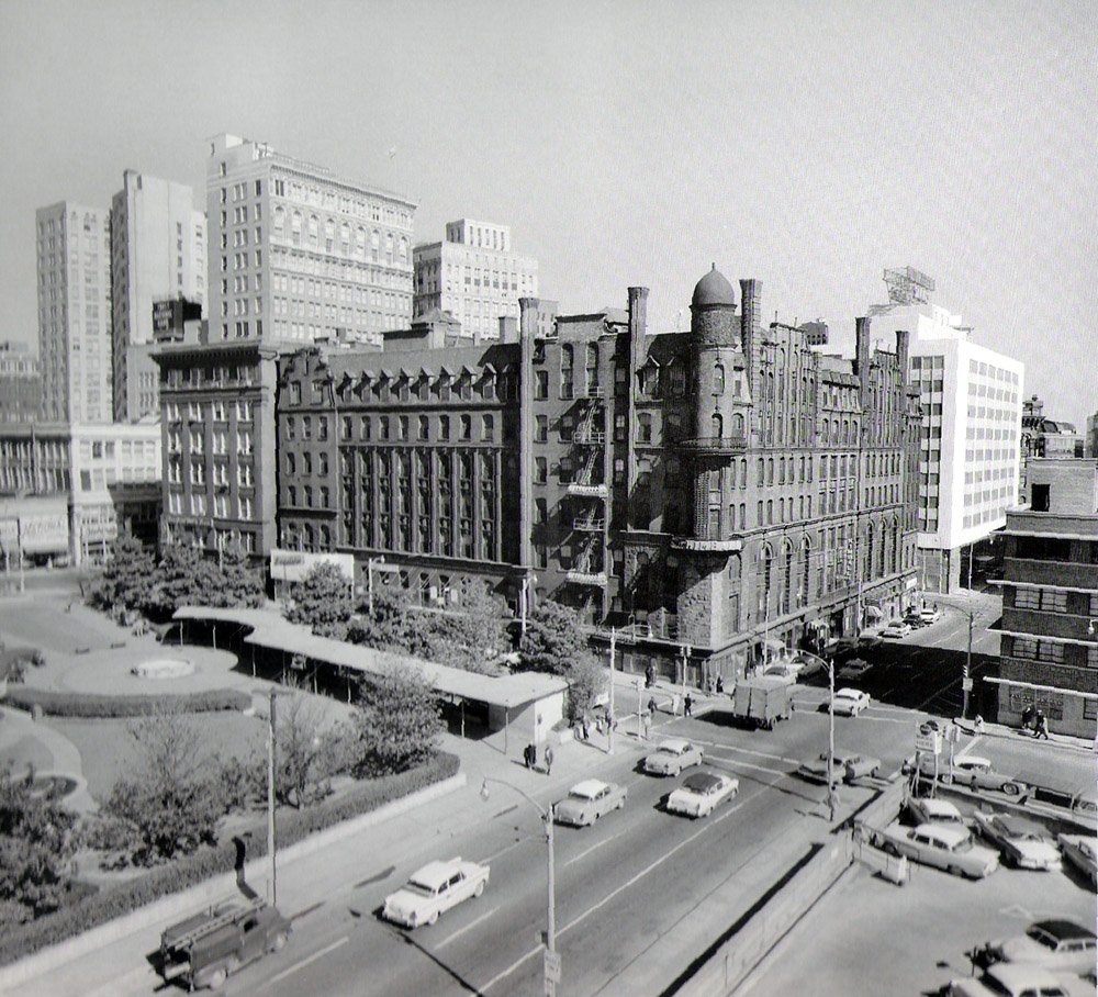
Some Hungarian-GSU connectionsToday, this area is just a short walk from the Atlanta campus of Georgia State University.
John Parkerson, appointed by the Government of Hungary as its Honorary
Consul for Georgia, Tennessee and the Carolinas is also a Board Member of
Georgia State University’s Center for Global Business Leadership.
GSU's Assistant Professor of Communication, Dr. Svetlana Kulikova,
happens to hold a Master degree in political science from Central
European University in Budapest, Hungary (1995).
|
Whimsical postscript: Beam me up, Scotty?The fictional Dr. Leonard McCoy, the irascible 23rd century ship's physician in the famous Star Trek universe, is well-known for his abiding suspicions about the "Transporter" device used to wirelessly teletransport people from place to place. As an Atlanta native, it is quite possible that this prejudice could stem from an unfortunate event which took place almost four centuries before his birth, and was dutifully recorded in the book Atlanta, yesterday, today and tomorrow (1922). Quoting exactly: Communication between Atlanta and the outside world, which is now carried on with so much ease by means of telegraph and telephone systems and numerous radio stations, was limited to the United States mails until the Spring of 1849, when the Macon and Western Branch Telegraph Company brought a line into the City from Macon... in 1850, another telegraph operator was sent to Atlanta in the person of Col. N. D. Sloan...[continuing] On another occasion, a group of young fellows encountered a farmer who had come to town for the purpose of sending a negro to Macon. They told him that it would be much cheaper to send the darky by telegraph, and so the farmer, the negro and the practical jokers all repaired to the office. Here the farmer and the negro were lined up and told to hold to a wire which connected with the battery, and both did an impromptu dance as they felt the force of the current. When the farmer found that he was the victim of a joke, he was furious and Col. Sloan had to vacate the office for a time in order to avoid a personal difficulty.Dammit, Jim, McCoy is a doctor - not a telegrapher!!! |
